maha alqahtani
Urban Planning Student

About
A fourth-year urban planning student, who previously had experience in one of the health specializations, but is still searching for herself until she found the urban planning major, a specialty that suits her, her thought, and her ambitions and goals. She seeks to make a difference and influence her field of work, especially in the Kingdom of Saudi Arabia. Through this website, she's honored to present some of her selected academic projects. hopefully you enjoy watching it!
Get to know me

Academic projects
Urban planning
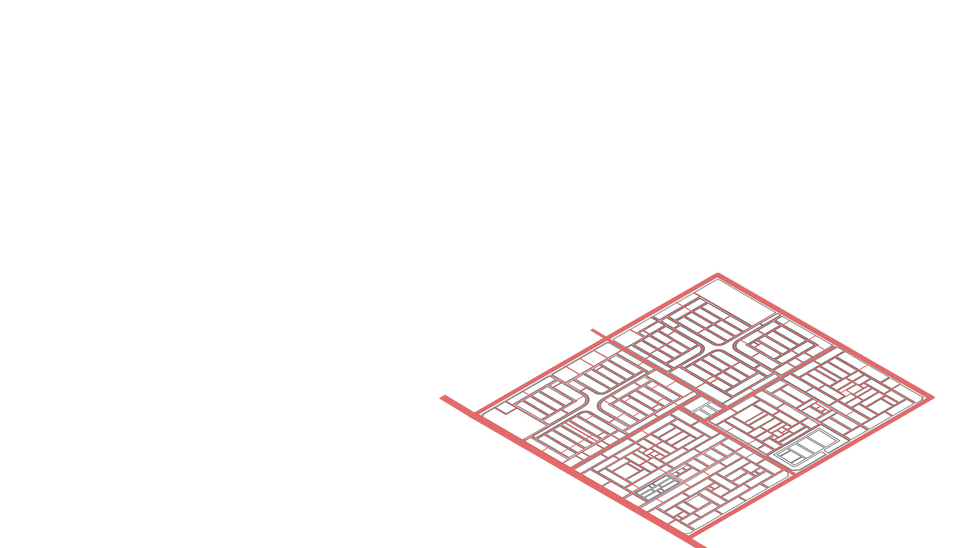
Academic project- Planning 1
Urban Environment Improvement Project
Supervised by Dr. Abdulaziz
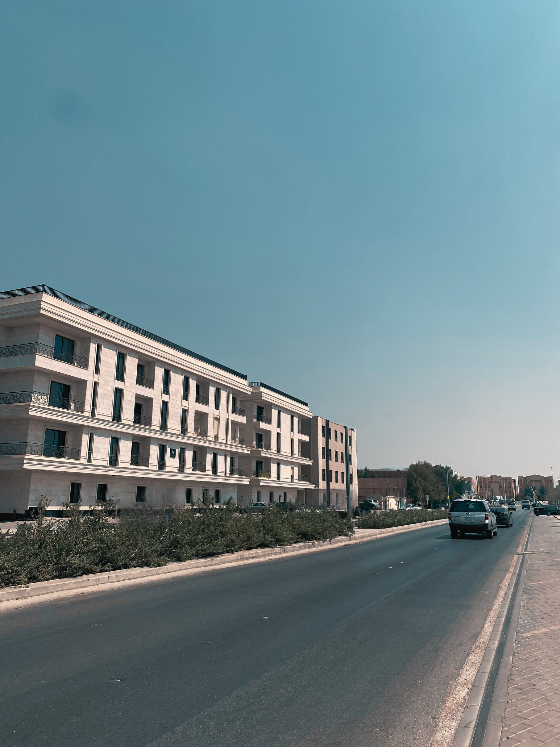
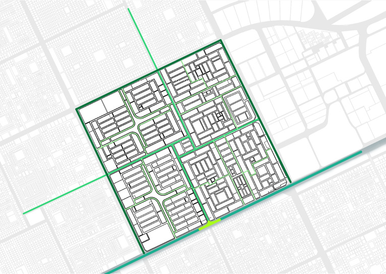
location: Riyadh
Area: 138000m^2
Urban design
Academic project- Design 4
Compound residential project
Supervised by Dr. Nesreen
location: Riyadh
Area: 138000m^2
Architectural design
Academic project- Design 3
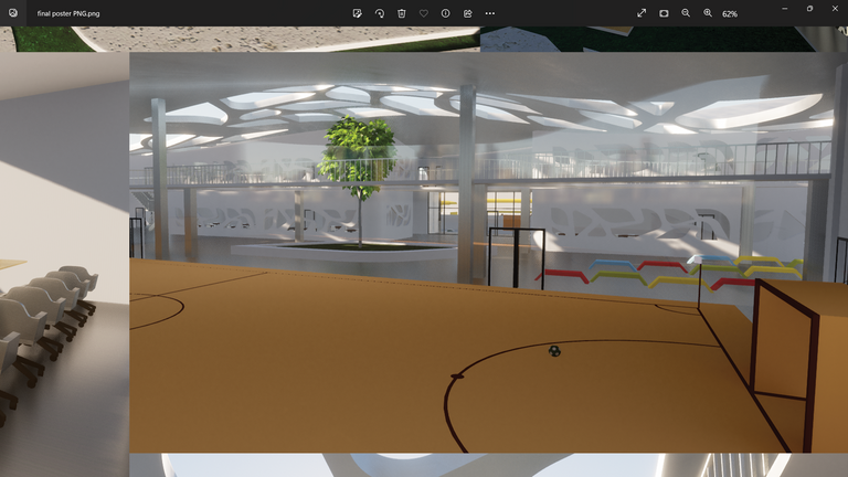
Elementary school project
Supervised by Dr. Sheren
location: Jeddah
Area: 12800m^2
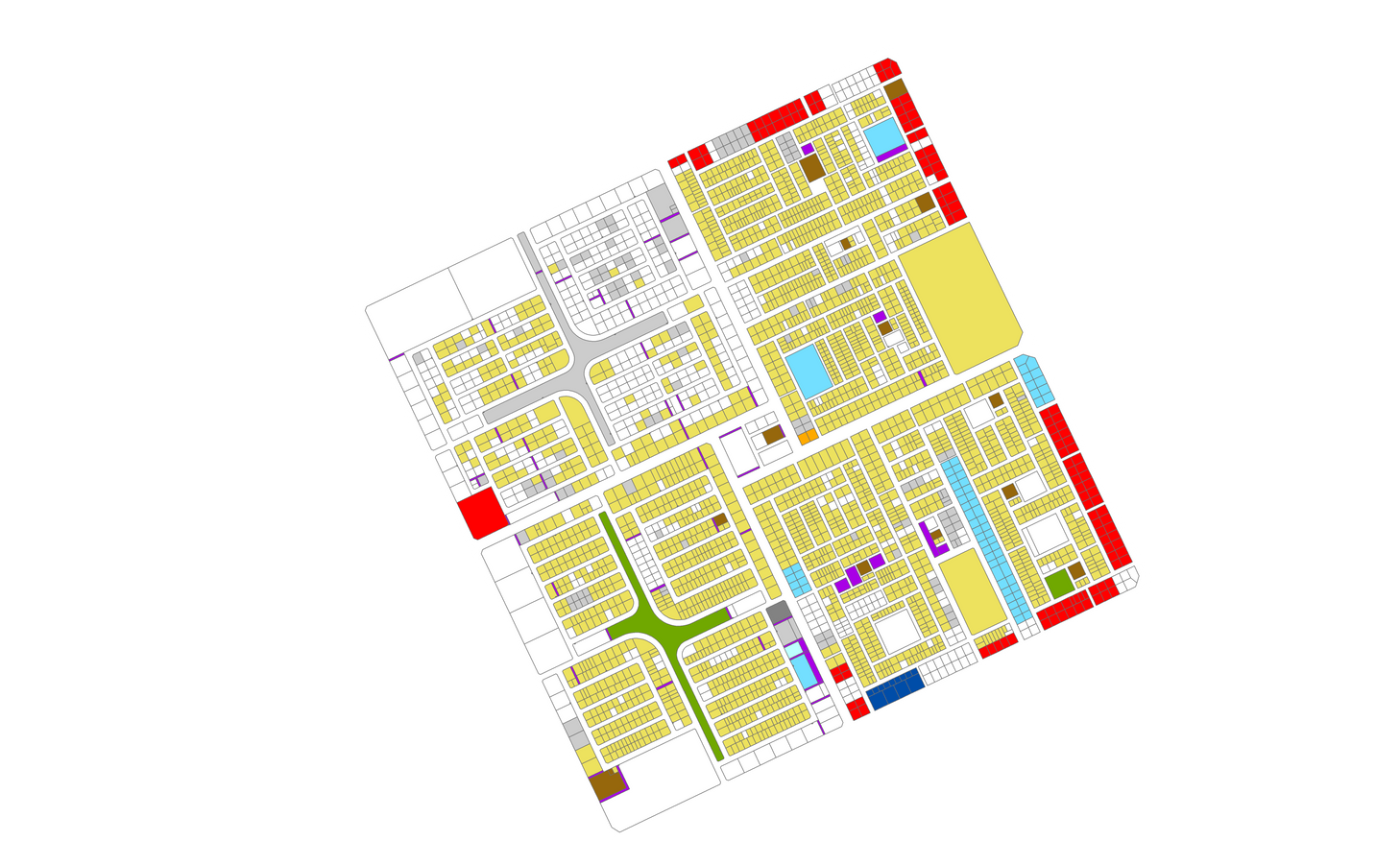
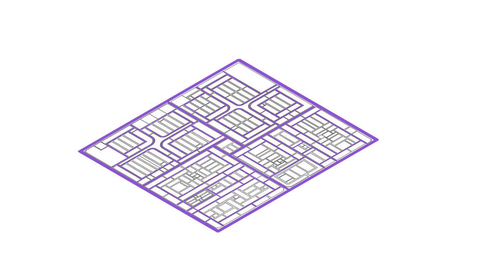
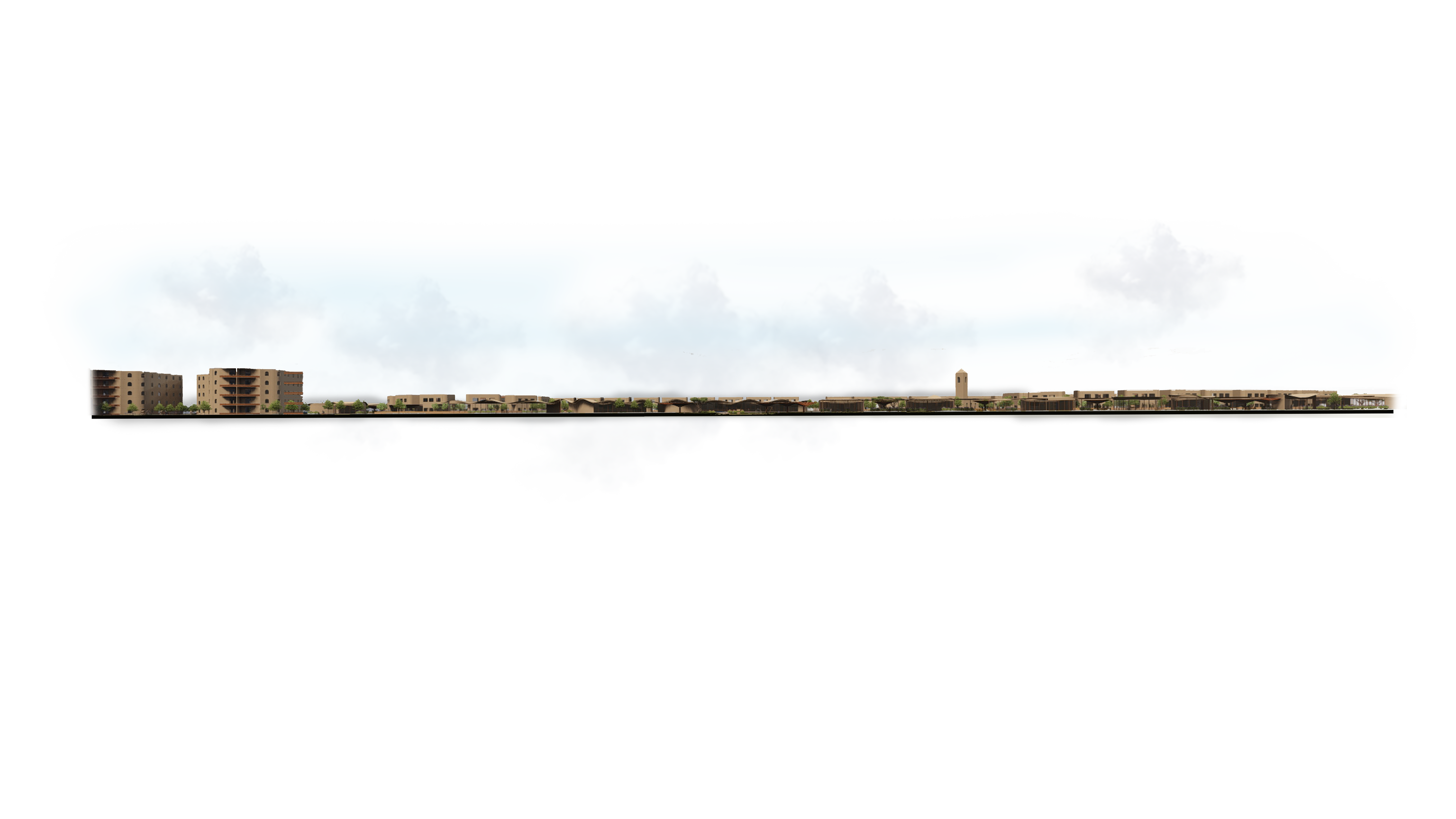
01- Urban renewal project
Urban planning
Academic project- planning 1
Urban Environment Improvement Project
Supervised by Dr. Abdulaziz
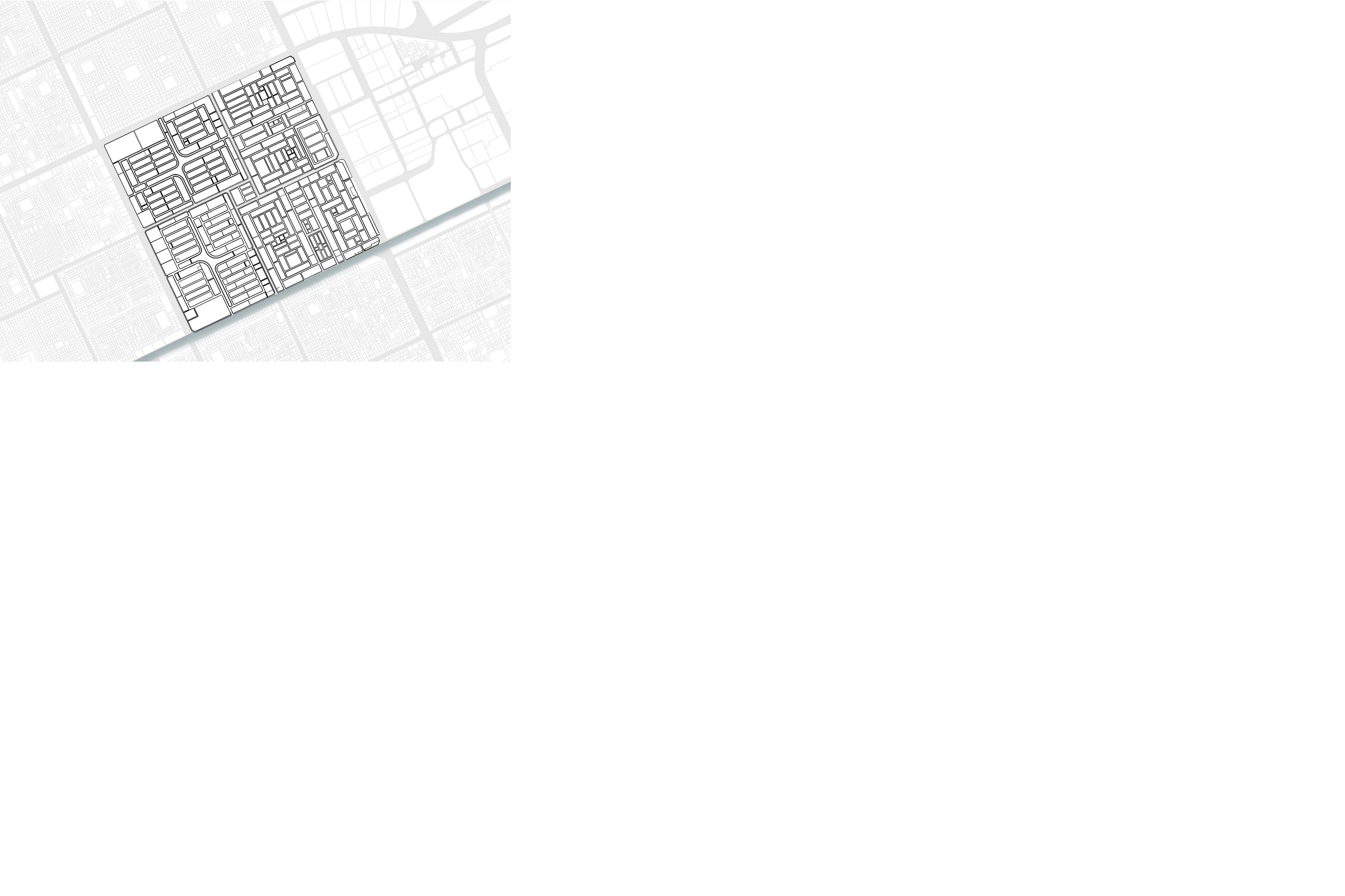
location: Riyadh, Al Nada Neighborhood
Area: 138000m^2
brief about planning 1
This project aims to improve urban planning by understanding its fundamentals and creating innovative solutions.
It will analyze a site, identify key issues, and develop appropriate solutions.
The project is expected to enhance understanding, create sustainable solutions, improve decision-making, and improve the quality of life for urban residents.
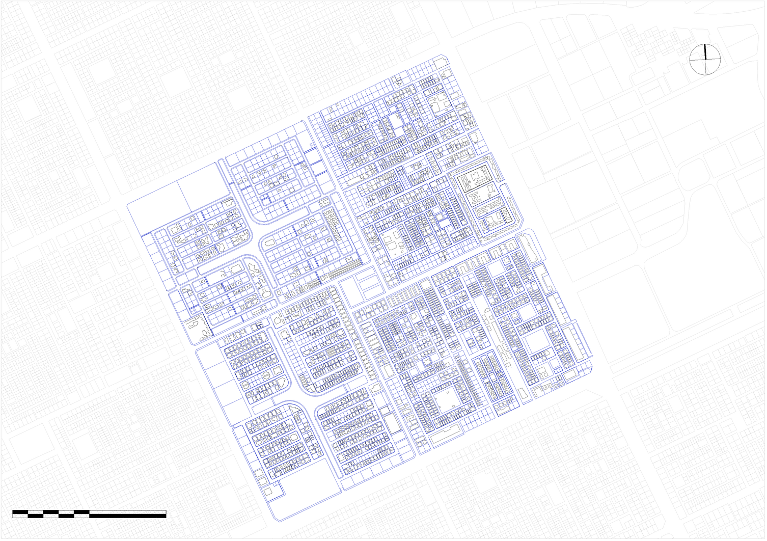
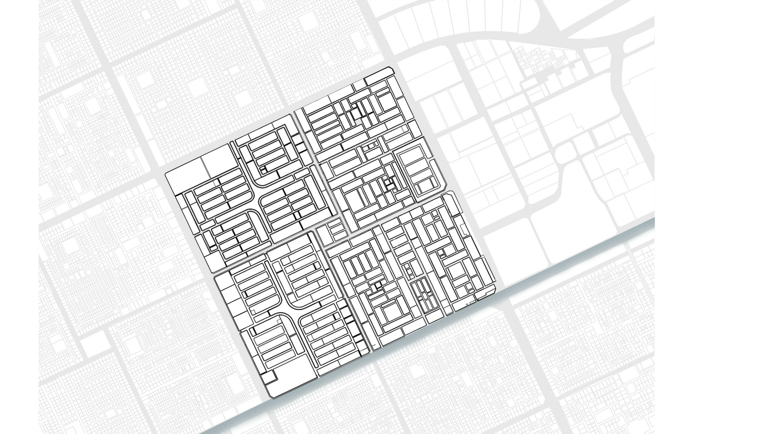
project's location
riyadh, Northern Municipality, Al Nada Neighborhood.
Design approach
Vision 2030 is an ambitious goal that aims to improve the health and well-being of individuals and communities globally. Among its key objectives is to promote public health and improve the quality of life for all. The public health approach to improving the built environment contributes to achieving this vision by integrating health dimensions into the design of cities and communities.
Principles of Public Health


Access to healthcare

Improving air and water quality


Eco-design and green buildings
Encouraging physical activity

Pedestrian-friendly urban design
Awareness and education
Community collaboration
Social interaction and mental health


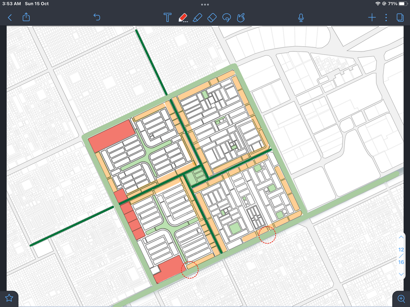
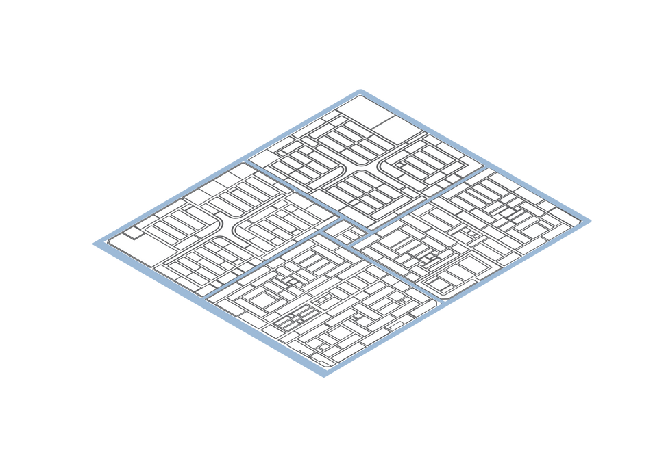
action plan
Harnessing the potential of vacant land to improve public health
Creating holistic, secure, and dynamic paths
Dealing with traffic jams and noise pollution
Balancing services across neighborhoods and blocks


0100
500
1000


Activating the neighborhood center
Easy access to public transportation
Adjusting the length of blocks
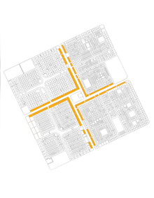
Harnessing the energy of the sport boulevard to revitalize the neighborhood


ا
حــــي النــدى
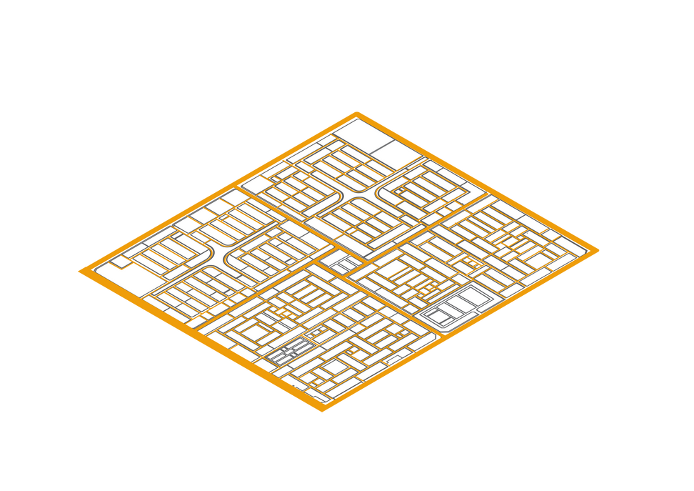
design's concept


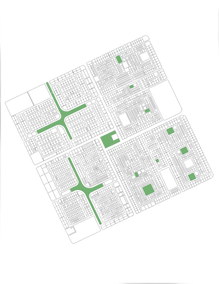
Commercial Uses
Mixed Uses
Green Areas
Arterial Streets
Main Streets
Linking to the sports boulevard
0100
500
1000

SPORT BOULEVARD
Reversing the identity of the athletic track to reflect on the neighborhood, encouraging walking by improving paths and the cityscape, distributing services to facilitate access to daily needs, and also focusing on improving mental and psychological health through sports and social interaction.
Core principles
- Integrating with the sports boulevard
- Promoting community engagement
- Ensuring accessibility to services
- Promoting sustainability
- Promoting sustainable transportation options
- Encouraging physical activity
- Enhancing urban vibrancy
- Creating a safe and attractive environment
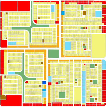
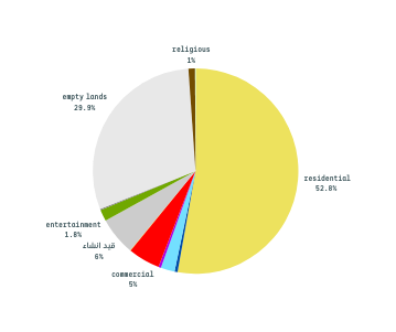
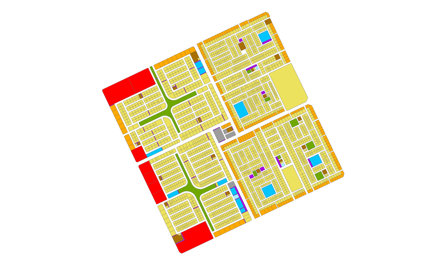
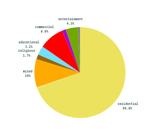
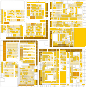
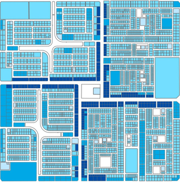
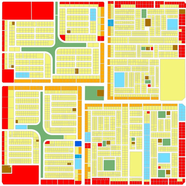
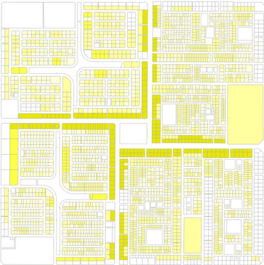
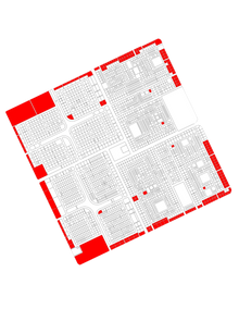
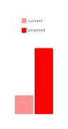
Comparison of Land Uses
Current situation
proposed situation
approved situation


health
0.07%
Residential use
Commercial use
Mixed use
Religious services, educational services
Health services
Entertainment services
public services
General facilities
Government facilities
Vacant lands
Under construction
0100
500
1000
facility
0.16%
mixed
0.08%
Residential use
Commercial use
Mixed use
Religious services, educational services
Health services
Entertainment services
public services
General facilities
Government facilities
Vacant lands
Under construction
0100
500
1000
health
0.3%
Residential use
Commercial use
Mixed use
Religious services, educational services
Health services
Entertainment services
public services
General facilities
Government facilities
Vacant lands
Under construction
0100
500
1000
facility
1.3%
public 0.7%
Achieving Goals

Linking to the sports boulevard

Promoting community engagement


Ensuring accessibility to services
Sports boulevard
Main Paths
Arterial Paths
Internal Paths
A connecting bridge
0100
500
1000


Interconnected Vital Pathways
Sports Centers
Open Sports Areas:
0100
500
1000
Blocks longer than 240m
0100
500
1000
Connecting with the sports boulevard through a pedestrian bridge. Connecting the tree-lined sports paths to each other to create an integrated network Reflecting the identity of the sports path by creating a sports identity at the neighborhood level, consistent with activities and colors.
Creating vital centers then connecting them to the neighborhood main center after activating it, taking into account the need for tranquility. Establishing Seasonal initiatives such as "Dukkah" and "Basata" and mini-markets equipped with dining tables.
Separating blocks that exceed 240 meters in length to create a pedestrian walkway, as the length of the blocks increases the time it takes for users and affects the efficiency of service areas.
After
block’s length 240m

Before
Achieving Goals
Promoting sustainability


sustainable transportation options

Encouraging physical activity

Vehicles Paths
VehiclesStations
0100
500
1000

Interconnected Vital Pathways
Green Spaces
0100
500
1000

Sports boulevard
Main Paths
Arterial Paths
Internal Paths
A Connecting Bridge
Sports Centers
Open Sports Areas
0100
500
1000
Increasing green spaces to reduce pollution, improve air quality, and mitigate temperature. Densifying trees on main internal streets and changing the timing of students' departure from schools to reduce noise. Creating tree-lined paths to encourage walking and reduce vehicle dominance.
Self-driving vehicles do not contradict the preservation of the health of the entire environment and humans.
Increasing the number of stations due to their small size and to achieve maximum accessibility.
Providing sports centers. Creating open sports activities. Improving the urban landscape and considering climatic factors. Integration and diversity of services to encourage walking. Creating integrated vital paths with shades and seating. Providing other healthy transportation means. Connecting with the sports area of the sports boulevard.


Achieving Goals
Increase in population density

Parking spots

building's height
villas
1227
Duplexes
1393
Townhouses
69
apartments
235
Very Low
Low
Medium
High
0100
500
1000
one floor
two floors
three floors
four floors
0100
500
1000
Parking
0100
500
1000
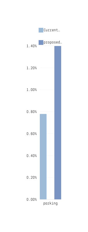
Implement the following regulations to increase density
Provision of surface parking based on need and in accordance with population density distribution. Making use of existing parking spaces, such as those at schools. Imposing nominal fees to be used for neighborhood development.
Building Heights Based on Projected Population Growth

one floor
1.3%

three floors
6%
Land subdivision
Subdivision of residential units
Achieving Goals

safe and attractive environment

street’s network

Mobility


Pedestrians and bicycles


bicycles


Self-driving vehicles
Vehicles
Converting a street into a pedestrian zone


Designing a Roundabout with Calculated Spacing
0100
500
1000

t
Arterial roads
main roads
Secondary roads
Local streets

C-C
A-A
B-B
Integration and diversification of commercial uses on the external edges of the neighborhood and mixed uses on the edges of the internal blocks, to serve the residents efficiently. Creating a safe neighborhood by addressing intersections and changing the terrain of the main internal streets.

1.8%
5%
5%
17%

8.2%
Replacing the Pavement of Main Streets
0.8%
streets number | 4 | 4 | 46 | 154 |
Sections
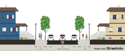
Local road section C-C
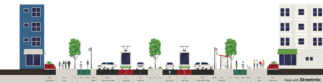
Main road section A-A
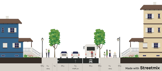
Secondary road section B-B
Implementation Stages
stage one
stage two
stage three
Sports boulevard
Main Paths
Arterial Paths
Internal Paths
A connecting bridge
0100
500
1000
Working on the public realm and connecting it with the sports path, while reflecting the urban identity of the path on the neighborhood.
Blocks longer than 240m
0100
500
1000
Addressing the identified blocks, then working on green spaces and activating sports and social activities within them.
Residential use
Commercial use
Mixed use
Religious services, educational services
Health services
Entertainment services
public services
General facilities
Government facilities
Vacant lands
Under construction
0100
500
1000
Gradually changing land uses as proposed, starting with mixed-use developments to serve the neighborhood more quickly.
ا
حــــي النــدى
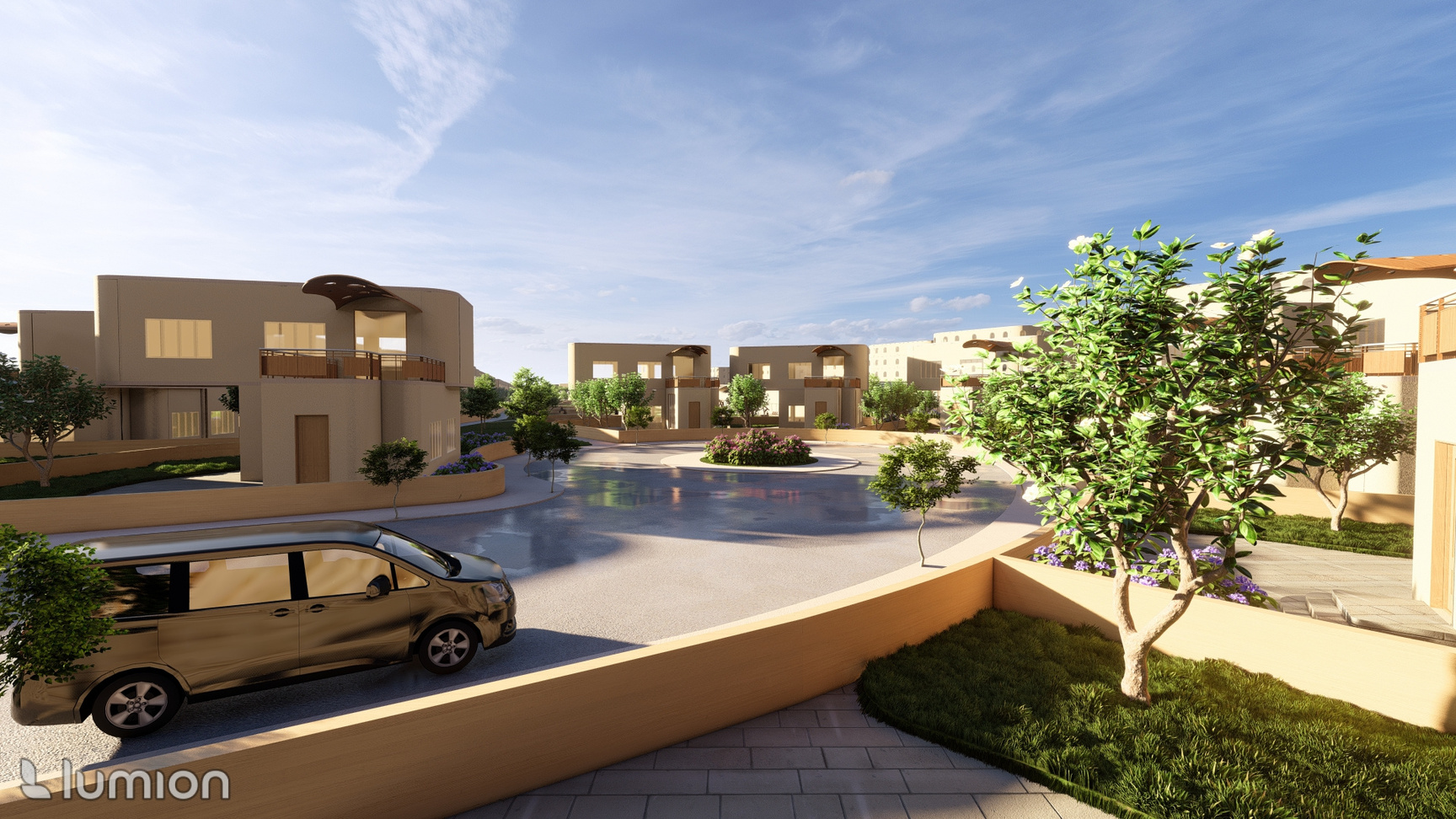
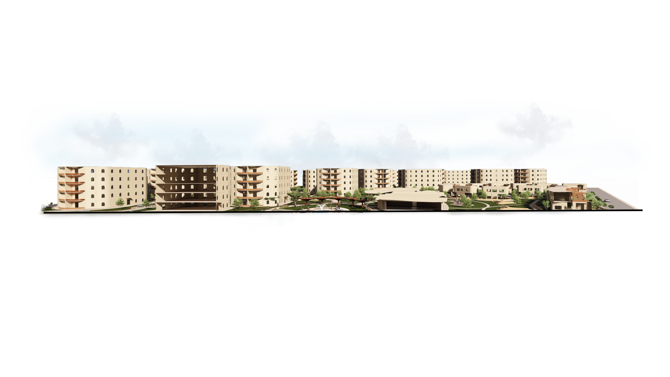
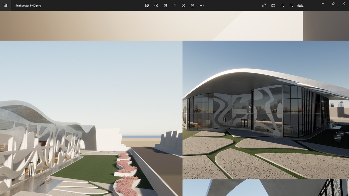
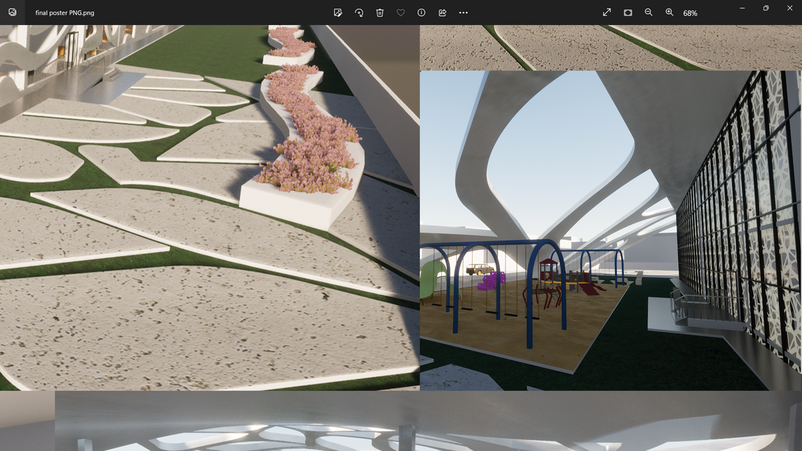
02- Anas compound project
Urban design
Academic project- Design 4
Compound residential project
Supervised by Dr. Nesreen
location: Riyadh
Area: 138000m^2
brief about design 4
A residential compound project designed for faculty members at King Saud University, with an area of 138,000 square meters, located in the city of Riyadh in the campus of King Saud University
project's location
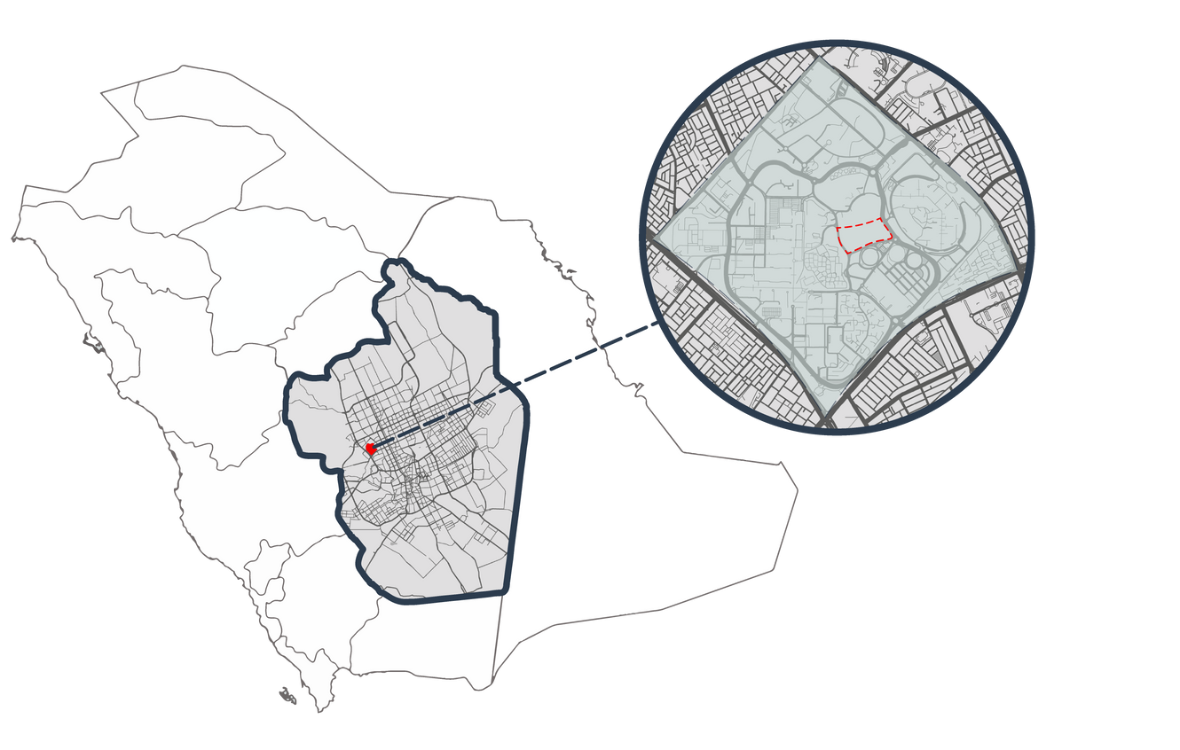
saudi arabia, riyadh, king saud university.
Design approach
Designing the residential complex to achieve the concept of human cities, which is in line with the Kingdom's vision for the year 2030.

human Cities criteria
- The primary means of transportation to nearby services is walking
- Achieving smooth movement and high reach
- Creating aesthetic aspects that enhance user movement
- sustainable environment
- Taking into account the climatic conditions and exploiting them
- Respect the privacy of residents
- Achieving security and safety
- Promote interactive activities among residents


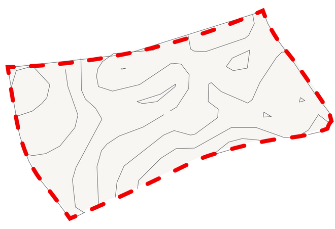
site analysis


W
W
S
S


665m
660m
63.7dBA
69.1dBA
645m
650m
655m
655m
645m
650m
650m
640m
635m
56dBA
61.9dBA
645m
0
35 m
75 m
150 m
300 m
W
W
S
S
Noise
Temporary noise
Desirable wind
Sun orientaion
current situation
69.1dBA
645m

645m
650m
61.9dBA
665m
655m
650m
650m
645m
655m
660m
640m
635m
63.7dBA
56dBA
0
35 m
75 m
150 m
300 m
The buildings in the surrounding area are in good condition
Visual distortion due to the parking of vehicles
Presence of temporary tents
Inconsistent noise due to the stadium
The site is surrounded by vacant lands in the north and west
The soil is not stable, and there is a high difference in levels
Vegan belt
A water channel
The land uses surrounding the site are educational, residential and spatial lands.
Existence of construction
Water way
Potential view
Vegan belt
Desirable wind
Noise
Temporary noise
The heights of the surrounding buildings' floors are three
action plan
2


0
35 m
75 m
150 m
300 m
Taking advantage of the northern facade and repelling stadium noise
Creating a special environment for the residential complex
Treating visual distortion of Parking
Repelling dust-laden winds
Take advantage of desirable winds
Considering street congestion when designing the entrance
Not to build on water drainage channels
Isolate the residential complex from the established project
Placing buildings with high floors to cast a shadow on the project
design's concept

Brief about nerve cell
It is a basic communicative unit that uses a large amount of energy, consisting of a nucleus, appendages, a cell body, and an axon terminal. In terms of function, they are divided into: sensory neurons (receive), motor neurons (interact after receiving), and conductive neurons (connecting between the sensory and motor neurons)
So the concept is to concentrating the vital natural part in the middle of the project and its branching to the rest of the project parts as in the cell (from more energy to less), where the commercial use is distributed along the neural axis due to its kinetic nature, and then to the surrounding parts of the project which represent the residential use due to its stillness and because it represents the receptor nerve cells, so the user begins to interact with his surroundings in a way that embodies his feelings.
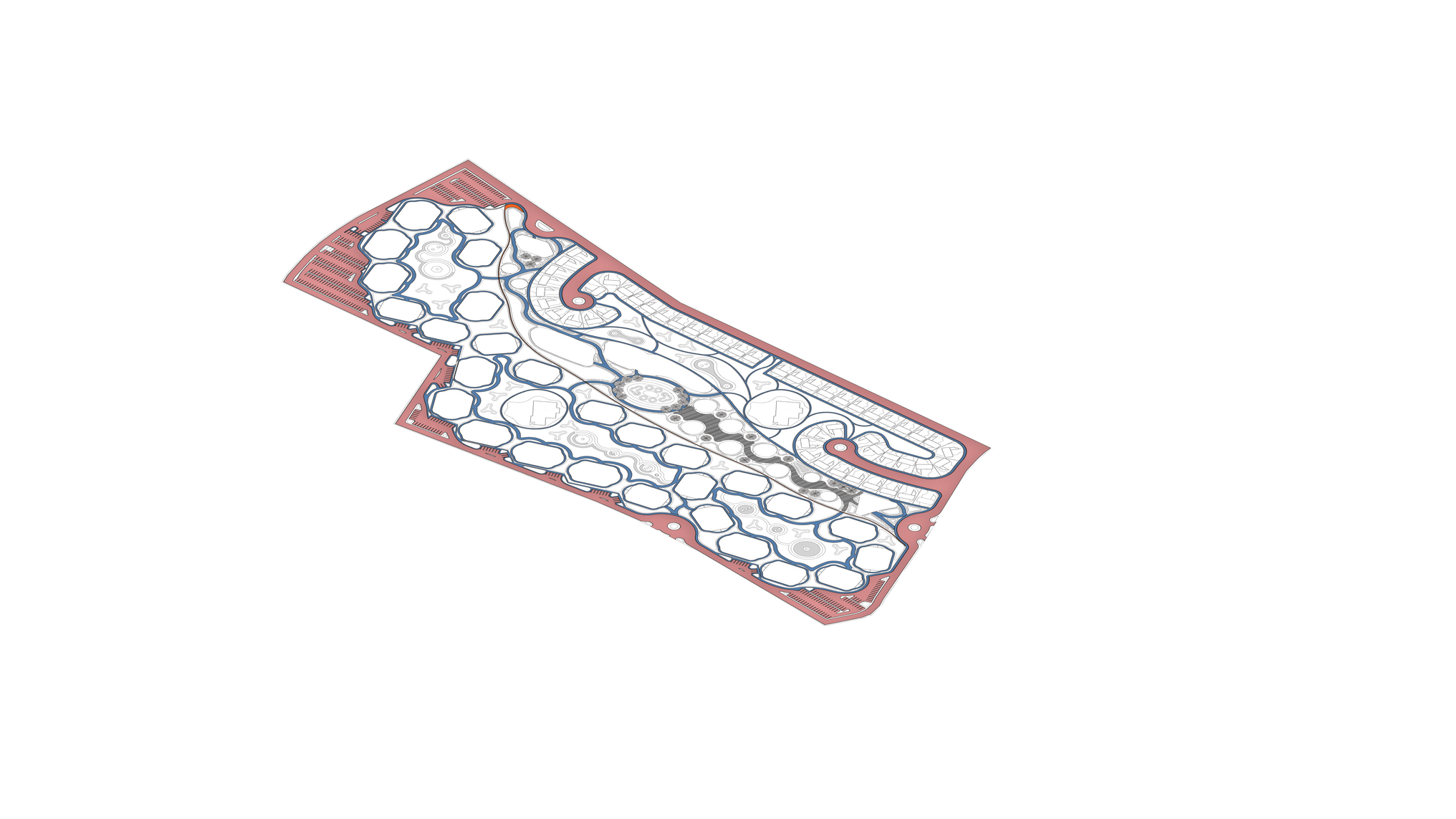
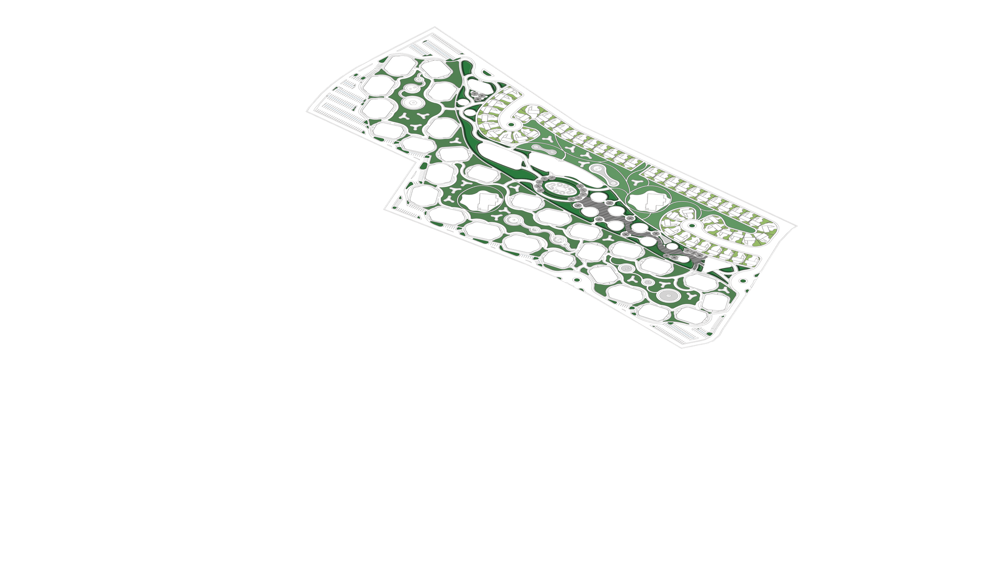
master plan
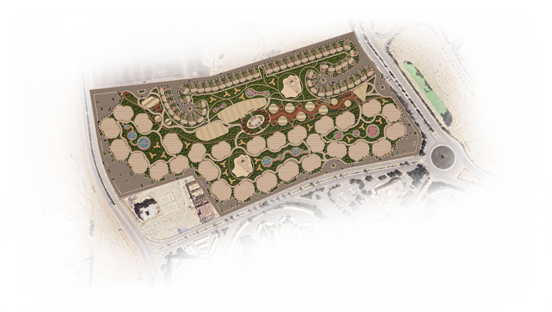
9
7
8
3
3
1
6
5
4
2
0
35 m
75 m
150 m
300 m
1.Villa
2. Apartments
3. Mosque
4. Administration building
5. Shops
6. Restaurants & coffees
7. Social & cultural building
8. Sport building
9. Super Market
sections
0
35 m
75 m
150 m
300 m
Section A:A
0
35 m
75 m
150 m
300 m
Section B:B
B
A
A
B
0
35 m
75 m
150 m
300 m
projects layers
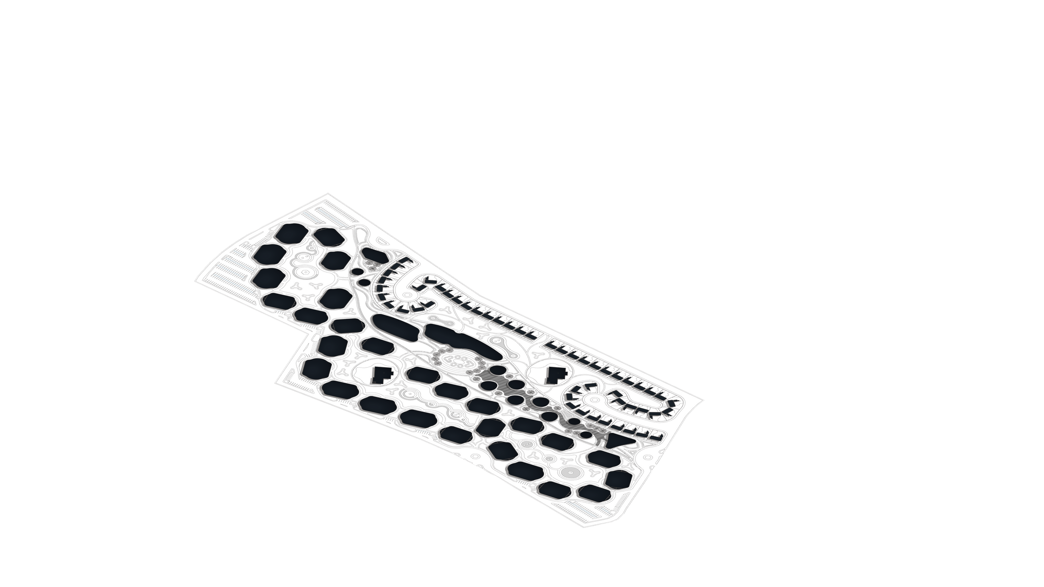
Cars circulation
Pedestrian circulation
Bicycles circulation
Public garden
Semi-privet garden
Privet garden
Solid
Void
different perspictives
different perspictives
Project's video

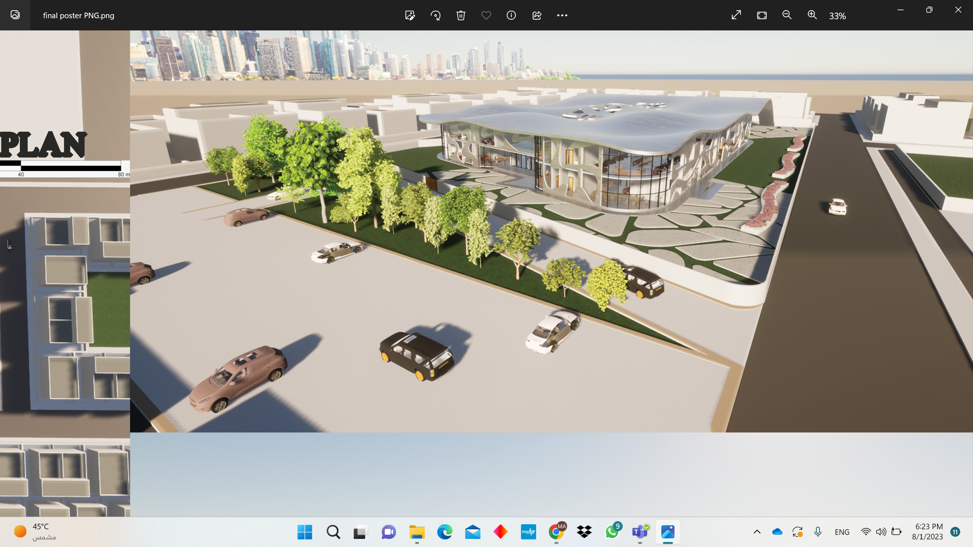
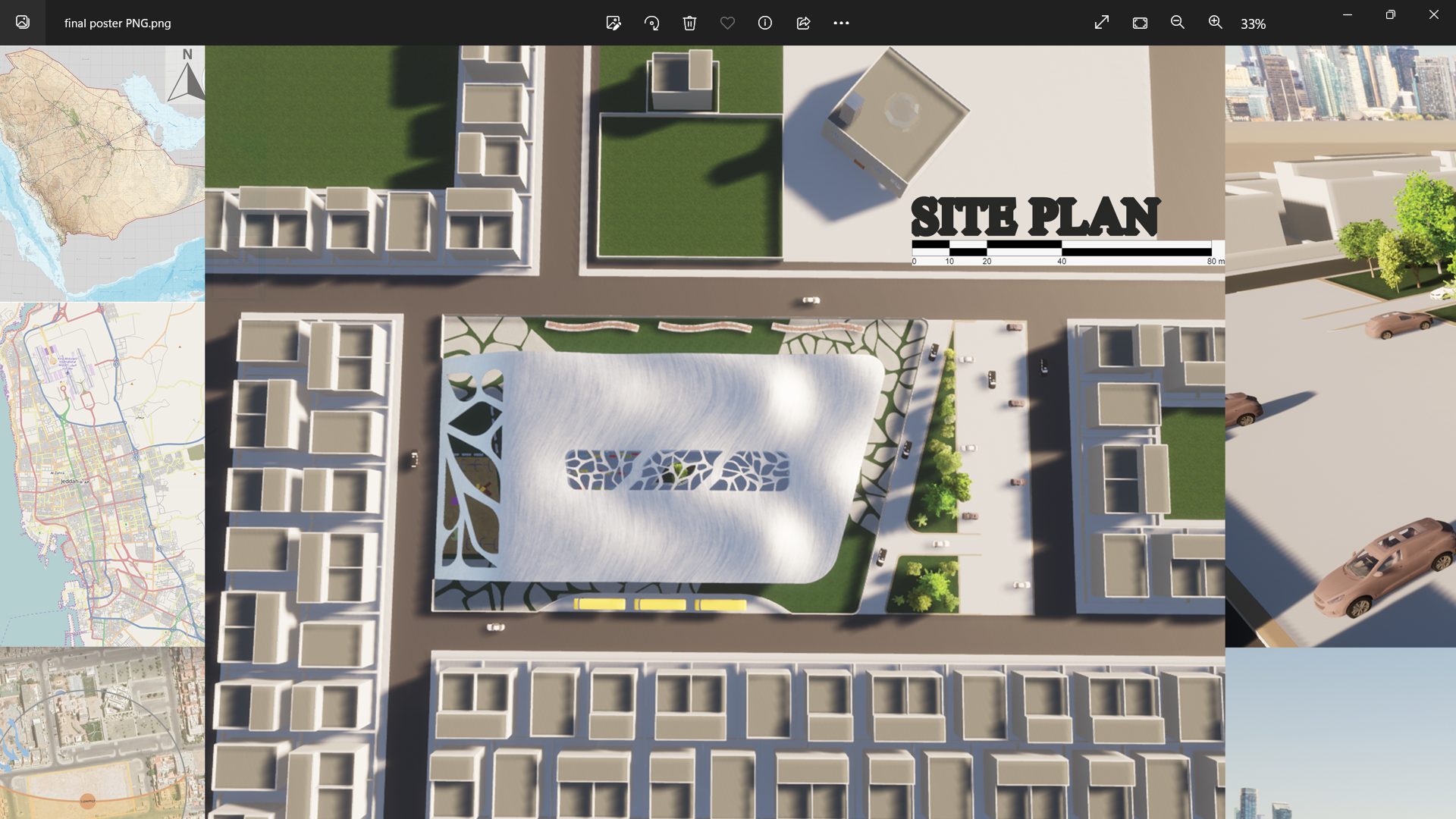
02- waves school project
Architectural design
Academic project- Design 3
Elementary school project
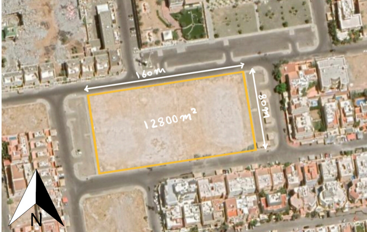
Supervised by Dr. Sheren
location: Jeddah
Area: 12800m^2
design's concept

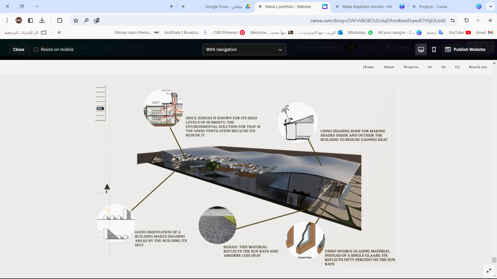
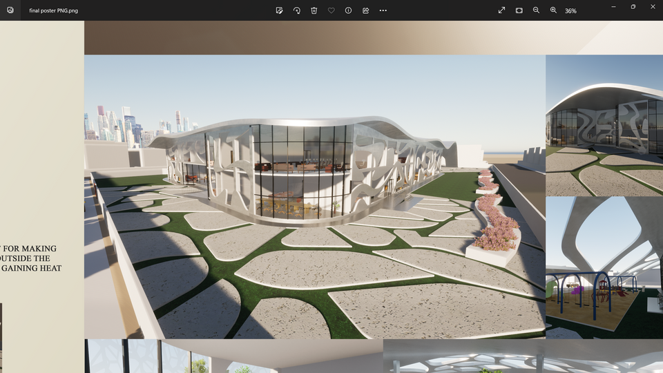
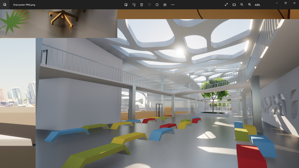
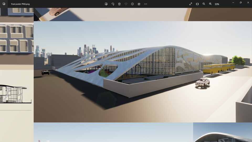
The concept is to reflex one of the features of Jeddah which is being a coastal city, hence the idea of the sea. In addition, the idea work in with the type of the design which is an elementary school, the Knowledge is like the sea, no matter how much you take from it, it does not run out, and waves are very strong as Knowledge which is the most powerful weapon a person can have.
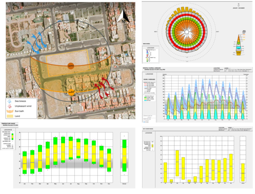
location & Climate analysis
site plan
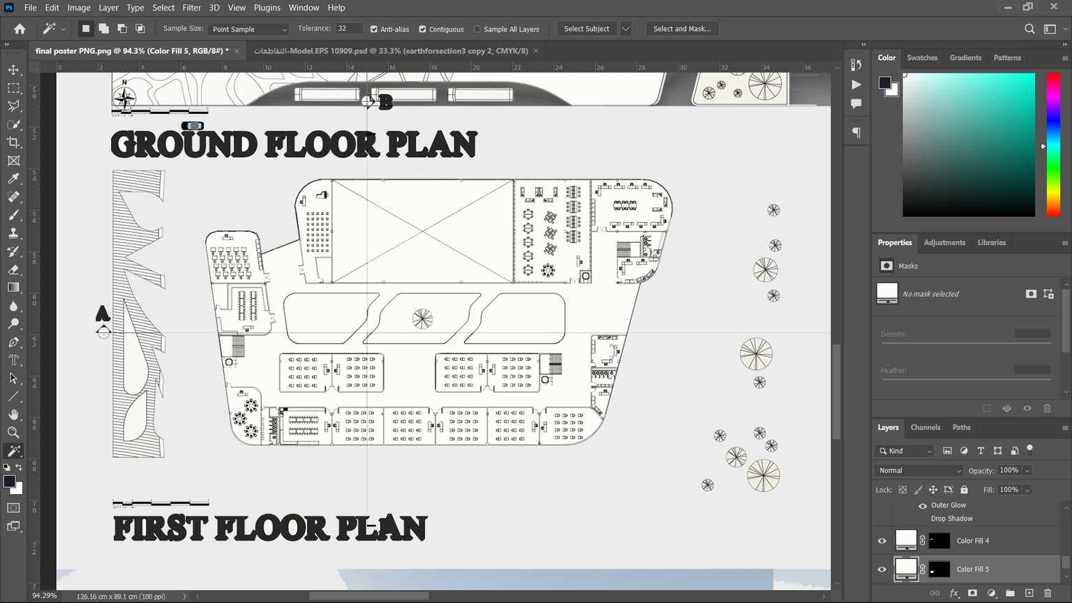
ground floor

first floor
sections
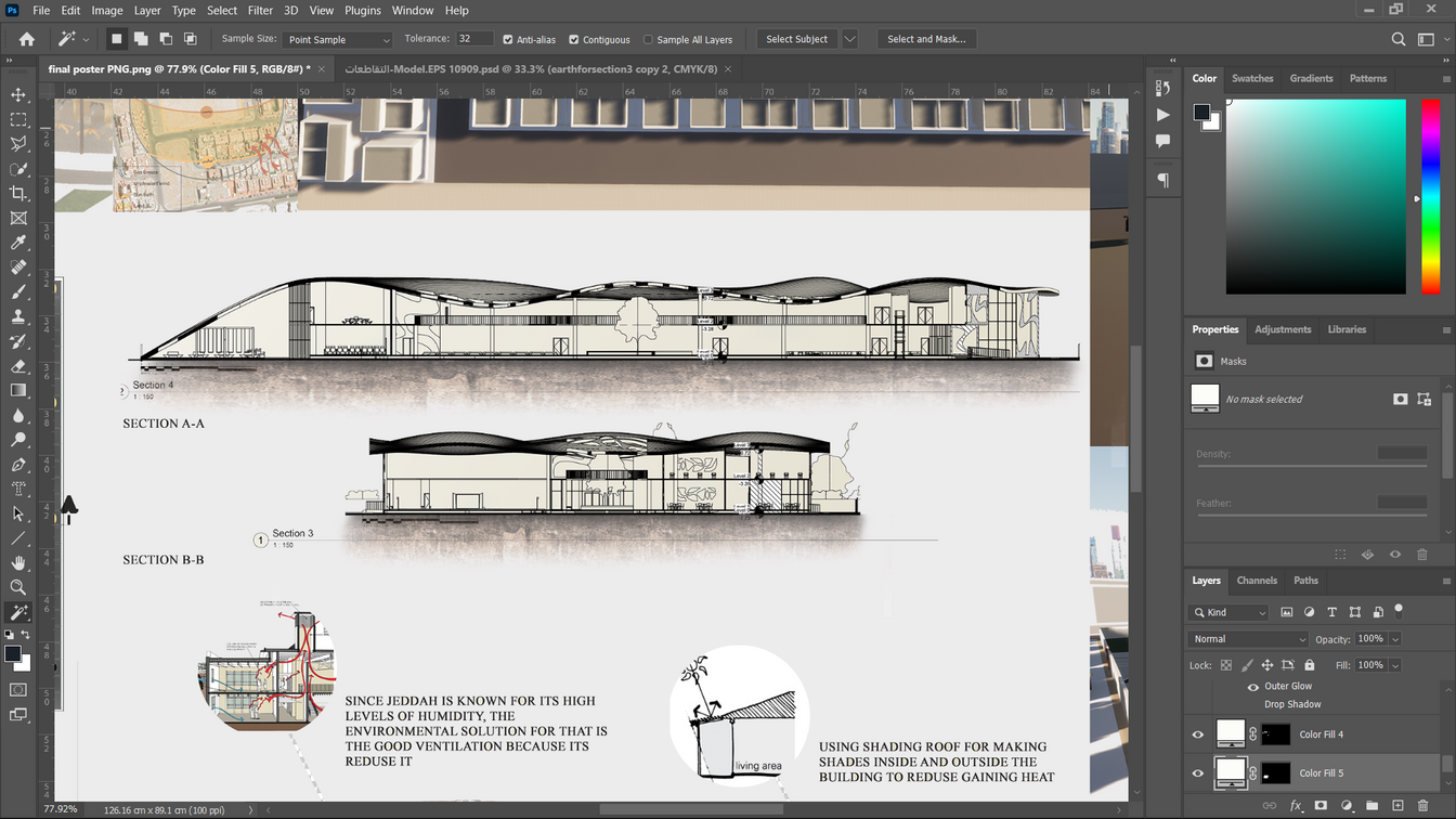
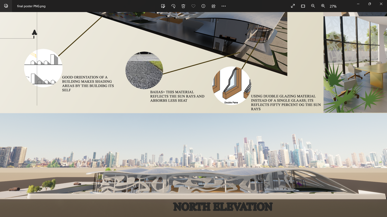
north elevation
west elevation
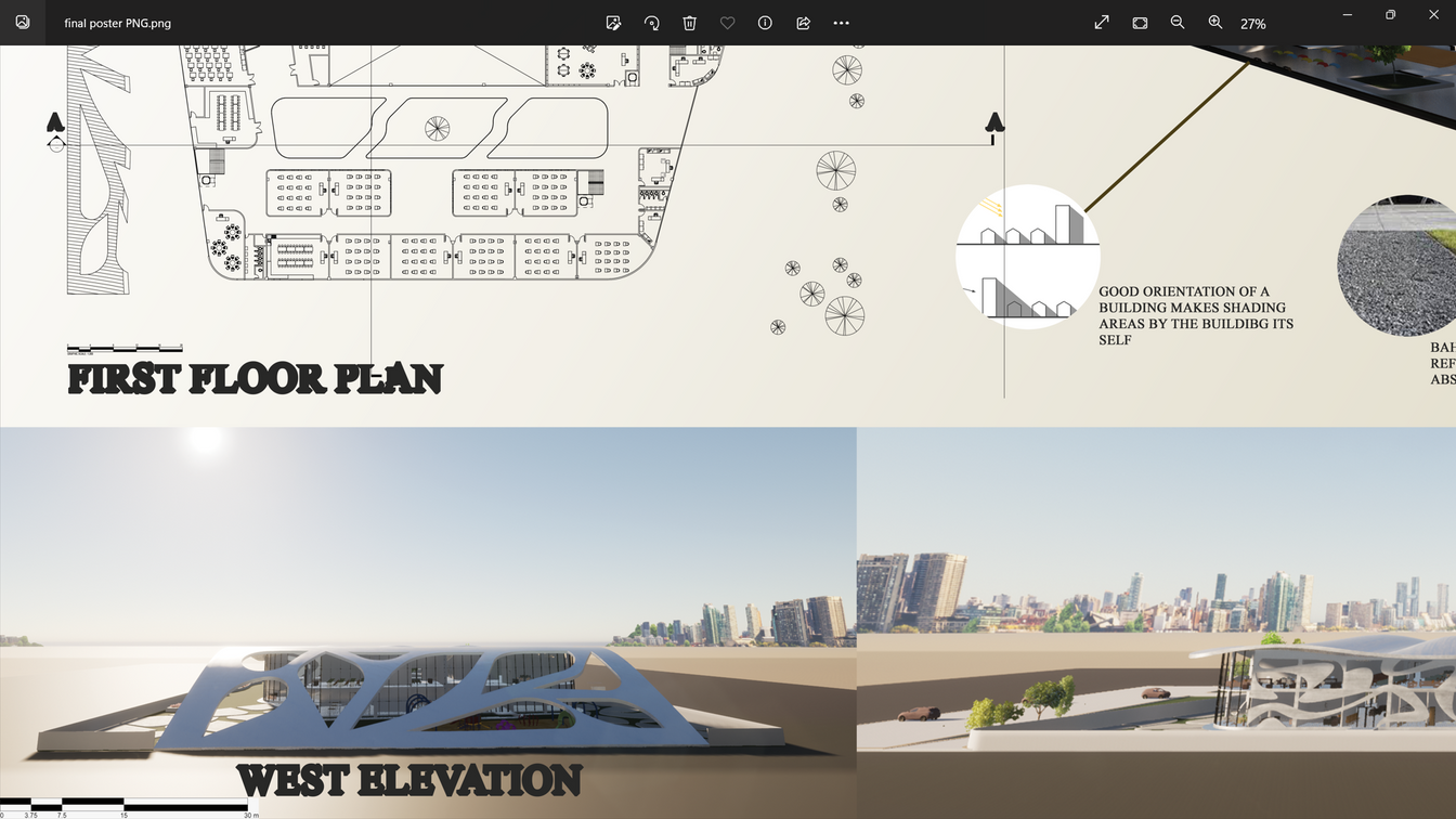
climate solutions
different perspictives
«لدينا عقليات سعودية مبهرة ورائعة جدًا، خاصة في جيل الشباب، طاقة قوية شجاعة، ثقافة عالية، احترافية جيدة وقوية جدًا، ويبقى فقط العمل. وطموحنا سوف يبتلع هذه المشاكل، سواء بطالة
أو إسكانا أو غيرها من المشاكل».
الأمير محمد بن سلمان
reach out


